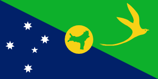
Overview
Although Europeans sighted Christmas Island in 1615, it was named for the day of its rediscovery in 1643. Steep cliffs and dense jungle hampered attempts to explore the island over the next two centuries. The discovery of phosphate on the island in 1887 led to the UK annexing it the following year. In 1898, 200 Chinese indentured servants were brought in to work the mines, along with Malays, Sikhs, and a small number of Europeans. The UK administered Christmas Island from Singapore.Japan invaded the island in 1942, but islanders sabotaged Japanese mining operations, making the mines relatively unproductive. After World War II, Australia and New Zealand bought the company mining the phosphate, and in 1958, the UK transferred sovereignty from Singapore to Australia in exchange for $20 million to compensate for the loss of future phosphate income. In 1980, Australia set up the Christmas Island National Park and expanded its boundaries throughout the 1980s until it covered more than 60% of the island’s territory. The phosphate mine was closed in 1987 because of environmental concerns, and Australia has rejected several efforts to reopen it.In the 1980s, boats of asylum seekers started landing on Christmas Island, and the migrants claimed refugee status because they were on Australian territory. In 2001, Australia declared Christmas Island to be outside the Australian migration zone and built an immigration detention center on the island. Completed in 2008, the controversial detention center was closed in 2018 but then reopened in 2019. In 2020, the center served as a coronavirus quarantine facility for Australian citizens evacuated from China.
Geography
- Location
- Southeastern Asia, island in the Indian Ocean, south of Indonesia
- Total Area
- 135 sq km
- Climate
- tropical with a wet season (December to April) and dry season; heat and humidity moderated by trade winds
- Terrain
- steep cliffs along coast rise abruptly to central plateau
- Natural Resources
- phosphate, beaches
- Coastline
- 138.9 km
- Land Borders
- 0 km
People & Society
- Population
- 1,692 (2021 est.)
- Languages
- English (official) 27.6%, Mandarin 17.2%, Malay 17.1%, Cantonese 3.9%, Min Nan 1.6%, Tagalog 1%, other 4.5%, unspecified 27.1% (2016 est.)
- Religions
- Muslim 19.4%, Buddhist 18.3%, Roman Catholic 8.8%, Protestant 6.5% (includes Anglican 3.6%, Uniting Church 1.2%, other 1.7%), other Christian 3.3%, other 0.6%, none 15.3%, unspecified 27.7% (2016 est.)
- Ethnic Groups
- Chinese 70%, European 20%, Malay 10% (2001)
Government
- Government Type
- non-self-governing overseas territory of Australia
- Capital
- The Settlement (Flying Fish Cove)
- Independence
- none (territory of Australia)
- Constitution
- 1 October 1958 (Christmas Island Act 1958)
- Legal System
- system is under the authority of the governor general of Australia and Australian law
- Executive Branch
- King CHARLES III (since 8 September 2022); represented by Governor-General of the Commonwealth of Australia General Sam MOSTYN (since 1 July 2024)
Economy
- Economic Overview
- high-income Australian territorial economy; development through government services and phosphate mining; operates Australia s Immigration Detention Centre; increasing tourism and government investments; sustained environmental protections
- Major Industries
- tourism, phosphate extraction (near depletion)
Infrastructure & Communications
- Railways
- 18 km (2017)